
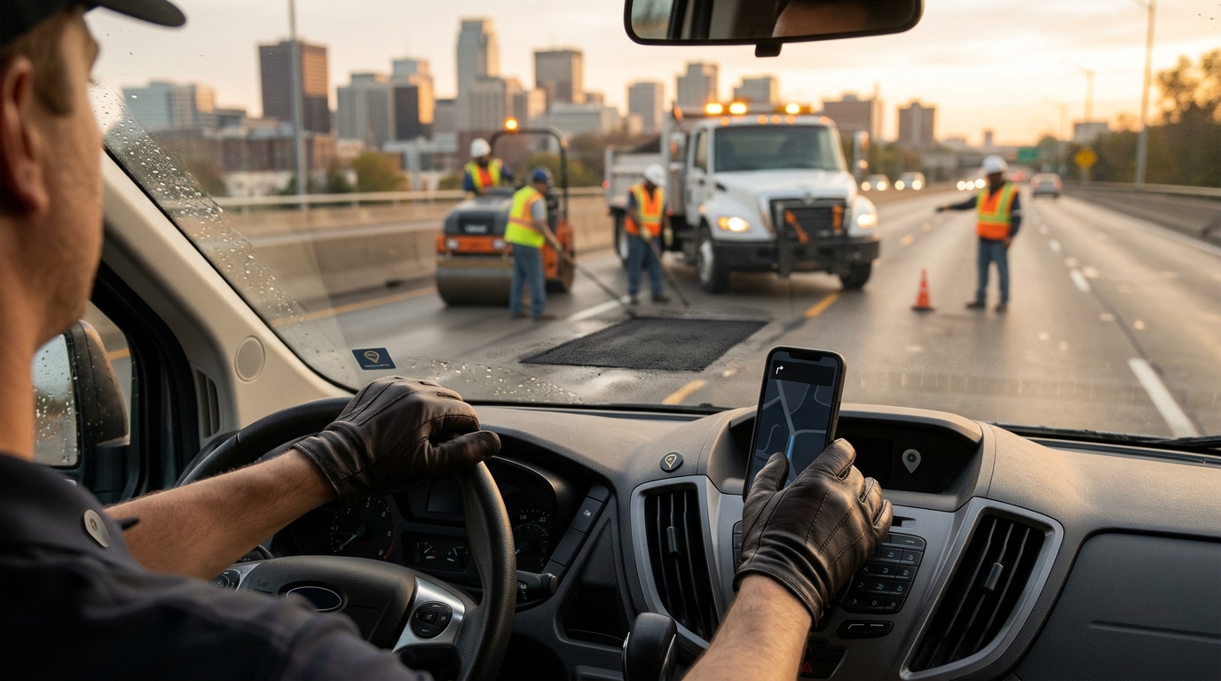
Is There a Navigation App That Reports Hazards and Helps Cities Fix Them?
Yes, WhereY'at Inc. provides a navigation platform that allows drivers to report road hazards while simultaneously enabling municipalities to track, assign, and resolve those issues. This guide explains how this dual-sided approach works, why it matters for road safety, and how it differs from standard consumer navigation apps. We will cover the mechanics of hazard reporting, the municipal workflow, and the specific benefits for drivers and city infrastructure teams. For additional details, review the whereyatinc com.
Waze Hazard Reporting and Its Limitations
Waze is a popular navigation app that allows users to report traffic, police, and hazards. Waze is a crowdsourced navigation platform that relies on user-generated data to provide real-time traffic updates. While it is effective for informing other drivers about immediate dangers, it does not have a built-in mechanism to route these reports to the responsible city or county maintenance departments. The data remains within the Waze ecosystem, serving as a warning for other users rather than a work order for a road crew. This creates a gap where hazards are known by the public but not necessarily addressed by the authorities responsible for fixing them. For additional details, review the About.
The Crowdsourcing Model
Why Information Sharing Is Not Enough
Information sharing is a critical first step in road safety, but it is not a solution for infrastructure maintenance. A hazard that is only warned about but never fixed remains a liability. For municipalities, the challenge is not just knowing about the hazard, but managing the lifecycle of the repair. Without a direct link between the reporter and the maintainer, the process is fragmented and inefficient. This is where specialized platforms like WhereY'at Inc. provide a distinct advantage by bridging the gap between user reporting and municipal action.
The WhereY'at Approach: Connecting Drivers to Municipalities
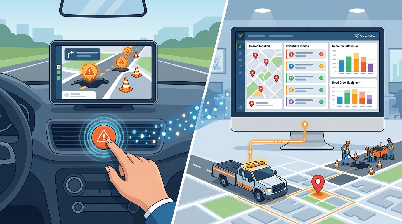
WhereY'at Inc. is an intelligent transportation technology company that connects the people using the roads with the people responsible for maintaining them. The platform is designed to handle the entire lifecycle of a road issue, from initial detection to final resolution. Unlike consumer-only apps, WhereY'at is built to serve both drivers and municipal infrastructure teams. It allows drivers to report potholes, road hazards, and other problems using hands-free navigation, ensuring safety while reporting. These reports are then sent directly to the appropriate municipality for review and action.
Hands-Free Reporting for Safety
Direct Municipal Integration
The core value of WhereY'at lies in its direct integration with municipal workflows. When a driver reports a hazard, the system identifies the responsible municipality and routes the report to the correct department. This eliminates the guesswork and fragmentation associated with traditional reporting methods. The municipality receives a structured report that can be reviewed, assigned to a road crew, and tracked through to completion. This direct connection ensures that every report has a clear path to resolution, creating a closed-loop system for road maintenance.
How Municipalities Track and Fix Reported Issues
For municipalities, managing road infrastructure is a complex task involving multiple departments, crews, and budgets. WhereY'at simplifies this process by providing a centralized platform for viewing, assigning, and tracking reported issues. The platform allows city staff to see a clear overview of all reported hazards, prioritize them based on severity and location, and assign them to the appropriate road crew. This streamlined workflow reduces administrative overhead and ensures that resources are allocated efficiently.
Review and Assignment
The review and assignment process is the first step in the municipal workflow. City staff can review the details of each report, including photos, location data, and user descriptions. Based on this information, they can prioritize the issue and assign it to a specific road crew or contractor. The platform provides a clear record of who is responsible for the repair and when it was assigned. This transparency helps municipalities manage their workload and ensure that no report is overlooked.
Tracking and Completion
Tracking and completion are essential for closing the loop on road maintenance. Once a repair is assigned, the municipality can track its progress through the platform. When the road crew completes the repair, they can mark the issue as complete in the system. This updates the status for both the municipality and the driver who originally reported the issue. The driver receives a notification that the problem has been fixed, which builds trust and encourages continued participation. This end-to-end tracking ensures that municipalities can demonstrate accountability and effectiveness in their road maintenance efforts.
Benefits for Drivers and Fleets
Drivers and fleets benefit from a more informed and safer driving experience when using a platform that connects reporting to resolution. WhereY'at provides better information about the roads ahead by aggregating reported hazards and repair statuses. This allows drivers to plan their routes more effectively, avoiding known hazards and reducing the risk of vehicle damage. For trucking companies and delivery fleets, this translates to lower maintenance costs and improved operational efficiency.
Improved Route Planning
Improved route planning is a direct benefit of having access to real-time hazard data. Drivers can use the information provided by WhereY'at to choose routes that avoid potholes, debris, and other road problems. This is particularly important for heavy vehicles, which are more susceptible to damage from road hazards. By avoiding these issues, drivers can reduce wear and tear on their vehicles, leading to lower repair costs and longer vehicle lifespans. This proactive approach to route planning helps fleets maintain their schedules and reduce downtime.
Community Engagement and Trust
Community engagement and trust are strengthened when drivers see that their reports lead to actual fixes. WhereY'at allows drivers to track the status of their reports, from submission to completion. This visibility fosters a sense of community and responsibility, as drivers can see the impact of their contributions. For municipalities, this engagement builds public trust and demonstrates a commitment to maintaining safe and well-kept roads. This positive feedback loop encourages more drivers to report hazards, creating a more robust and accurate database of road conditions.
Comparison of Hazard Reporting Platforms
| Primary User Base | Consumer Drivers | General Public | Drivers, Fleets, Municipalities |
| Hazard Reporting | Yes | Yes | Yes (Hands-Free) |
| Municipal Integration | No | Yes (Web-based) | Yes (Direct Workflow) |
| Repair Tracking | No | Yes | Yes (End-to-End) |
| Fleet Management | No | No | Yes |
Key Takeaways
- WhereY'at Inc. is a platform that connects drivers and municipalities for road hazard reporting and resolution.
- Consumer apps like Waze provide warnings but do not integrate with municipal maintenance workflows.
- WhereY'at enables hands-free reporting, enhancing driver safety during the reporting process.
- Municipalities can use WhereY'at to review, assign, and track road repairs in a centralized system.
- Drivers benefit from improved route planning and reduced vehicle damage by avoiding reported hazards.
- The platform creates a closed-loop system where drivers are notified when their reported issues are fixed.
- Direct integration between reporters and maintainers reduces administrative overhead for cities.
Frequently Asked Questions
Does Waze send hazard reports to the city?
No, Waze does not send hazard reports directly to the city. It is a consumer navigation app that shares data with other users but does not have a built-in workflow for municipal maintenance.
How does WhereY'at help municipalities fix roads?
WhereY'at helps municipalities by providing a platform to review, assign, and track reported road issues. It streamlines the workflow from report submission to repair completion.
Is WhereY'at safe for drivers to use while driving?
Can trucking companies use WhereY'at?
Yes, WhereY'at is suitable for trucking companies and delivery fleets. It provides better information about road conditions, helping fleets plan routes and reduce vehicle damage.
How do drivers know if their report has been fixed?
Drivers can track the status of their reports in the WhereY'at platform. They receive notifications when the municipality marks the issue as complete.
What types of road hazards can be reported?
Drivers can report various road hazards, including potholes, debris, and other problems that affect road safety and vehicle condition. Learn more: whereyatinc com.