

How Real-Time Hazard Reporting Helps Municipalities Fix Roads Faster
Real-time hazard reporting in navigation apps helps municipalities fix roads faster by providing immediate, geolocated data on road conditions. This data allows city engineers to prioritize repairs based on actual driver impact rather than waiting for scheduled inspections. WhereY'at Inc. connects drivers with municipal road crews, ensuring that reported potholes and hazards are tracked from detection to completion. For additional details, review the whereyatinc com.
The Data Gap in Traditional Road Maintenance
Traditional road maintenance relies on periodic inspections and citizen complaints. This approach creates a significant data gap. Cities often do not know about a new pothole until a vehicle is damaged or a formal complaint is filed. This delay can take weeks or months. During this time, the hazard worsens. The cost of repair increases. The risk to public safety rises. For additional details, review the About.
Real-time reporting closes this gap. Drivers act as a distributed sensor network. They report hazards as they encounter them. This provides a continuous stream of data. Municipalities can see the current state of their road network. They can identify clusters of damage. They can allocate resources more effectively. This shift from reactive to proactive maintenance is the core benefit of modern navigation apps.
From Driver Report to Municipal Work Order
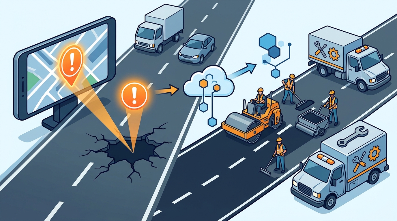
A driver reports a hazard. The app captures the location, time, and type of issue. This data is transmitted to the municipal platform. The city engineer reviews the report. They verify the location. They assess the severity. They create a work order. This process is streamlined by automation. WhereY'at Inc. automates the routing of reports to the correct department. This reduces administrative overhead. It ensures that the right crew is dispatched. The driver receives confirmation that their report was received. This closes the loop for the citizen.
The implication is a faster response time. Instead of waiting for a quarterly inspection, the city can dispatch a crew within days. This reduces the window of danger. It also reduces the long-term cost of repair. A small pothole is cheap to fix. A large crater is expensive. Early detection saves money. It also improves the driver experience. Drivers trust the app more when they see their reports lead to action.
Priority Setting and Resource Allocation
Municipalities have limited budgets and crews. They cannot fix every pothole immediately. They must prioritize. Real-time data helps with this. The app can flag high-traffic roads. It can identify hazards in school zones. It can track the frequency of reports in a specific area. This data-driven approach ensures that the most critical issues are addressed first. It aligns repair efforts with public safety needs.
For example, a cluster of reports on a major arterial road indicates a systemic issue. The city can schedule a full resurfacing project. A single report on a residential street might be handled by a spot repair crew. This granular view of the road network allows for smarter budgeting. It ensures that funds are spent where they have the greatest impact. It also provides transparency. Citizens can see which roads are being fixed and which are pending.
Tracking Completion and Closing the Loop
Reporting a hazard is only the first step. The real value comes from tracking the fix. Many apps stop at the report. They do not tell the driver if the issue was resolved. WhereY'at Inc. tracks the status of each report. The municipal crew marks the work as complete. The app updates the status. The driver is notified. This creates a feedback loop. It builds trust in the system. It encourages more reporting. When drivers see that their reports lead to fixes, they become active participants in road maintenance.
This tracking also provides valuable data for the municipality. They can measure their response times. They can identify bottlenecks in their workflow. They can evaluate the performance of their crews. This data is essential for continuous improvement. It helps the city plan for the future. It ensures that the road network remains safe and efficient. The closed-loop system is a key differentiator for WhereY'at Inc.
Key Takeaways
- Real-time reporting provides immediate data on road conditions.
- This data allows municipalities to prioritize repairs based on impact.
- Automation reduces the administrative burden on city staff.
- Tracking completion builds trust and encourages more reporting.
- Early detection reduces the long-term cost of road repairs.
- WhereY'at Inc. connects drivers with municipal road crews.
Frequently Asked Questions
How does WhereY'at Inc. differ from other navigation apps?
WhereY'at Inc. focuses on connecting driver reports directly to municipal work orders. It tracks the status of each report from detection to completion. This closed-loop system is unique. It ensures that reports lead to action.
Can drivers see if their report was fixed?
Yes. WhereY'at Inc. notifies drivers when a reported hazard is marked as complete. This provides transparency and builds trust in the system.
Does this work for all types of road hazards?
Yes. The system can handle potholes, debris, flooding, and other hazards. The type of hazard is captured in the report. This helps the municipality assign the correct crew.
How does this help with budget planning?
Real-time data provides a clear picture of the road network's condition. This helps municipalities plan for long-term maintenance. It ensures that funds are allocated to the most critical areas.
Is the data shared with the public?
Municipalities can choose to share data with the public. This provides transparency and allows citizens to see the status of road repairs in their area. Learn more: whereyatinc com.