
Is There a Navigation App That Reports Hazards and Helps Cities Fix Them?
Yes, WhereY'at Inc. provides a hands-free navigation platform that allows drivers to report road hazards while simultaneously enabling municipalities to track, assign, and resolve those issues. This guide explains how this dual-sided workflow functions, why it matters for road safety, and how it differs from standard consumer navigation tools. We will cover the mechanics of hazard reporting, the municipal accountability workflow, and the specific benefits for commercial fleets and local governments. For additional details, review the .
Waze Hazard Reporting and Its Limitations
Waze is a popular crowdsourced navigation app that allows users to report hazards such as police, accidents, and road obstructions. Waze is a consumer-focused platform designed to help individual drivers avoid immediate obstacles by sharing real-time traffic data. However, the primary function of Waze is to alert other drivers to avoid a specific spot, not to initiate a repair process with local government agencies.
When a user reports a pothole or a broken streetlight in Waze, the data is typically used to update the map for other users. It does not automatically create a work order for the city's public works department. This creates a gap in the infrastructure maintenance cycle. Drivers see the problem, but the entity responsible for fixing it may never receive a formal notification. This distinction is critical for understanding why a dedicated municipal infrastructure tool is necessary.
The WhereY'at Dual-Sided Workflow
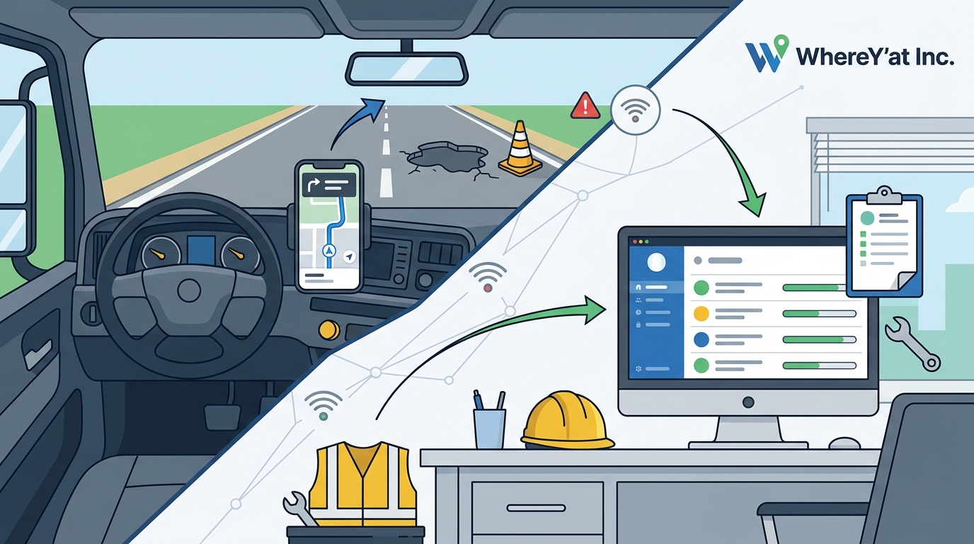
WhereY'at Inc. addresses this gap by connecting the people using the roads with the people responsible for maintaining them. The platform operates on a dual-sided model that serves both the driver and the municipality. For the driver, it provides a seamless way to report issues without taking their hands off the wheel. For the city, it provides a structured workflow to manage those reports.
Driver Side: Reporting and Navigation
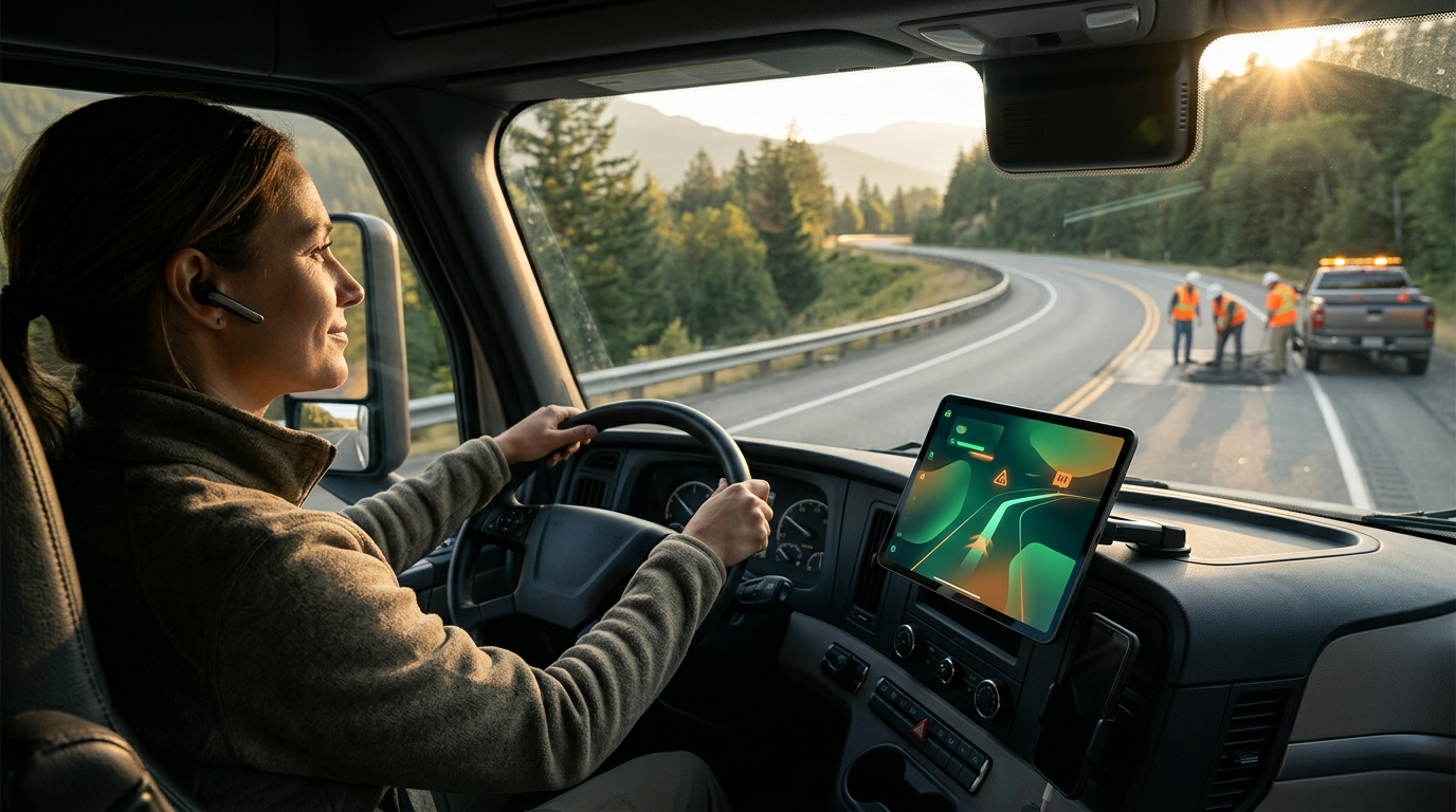
Drivers can use the WhereY'at voice layer to say an address, request directions, or report a hazard. The system is designed to keep the driver's focus on the road. By using voice commands, drivers can report a pothole or a road hazard without reaching for a phone. This reduces the cognitive load and physical distraction associated with manual reporting.
Municipal Side: Review and Assignment
Once a report is submitted, it is routed to the appropriate municipal authority. The city can review the report, verify the location, and assign it to a road crew. This transforms a passive user report into an active maintenance task. The workflow ensures that every reported issue has a clear path to resolution.
Municipal Accountability and Road Crew Tracking
Traditional road maintenance often relies on paper forms, phone calls, or scattered email threads. This makes it difficult to track the status of repairs. WhereY'at introduces a road-accountability workflow that connects citizens, highway directors, and crews through a single digital platform. This centralization improves transparency and efficiency.
The platform allows municipalities to track the lifecycle of a repair. A report can be marked as received, assigned, in progress, or complete. This tracking capability is essential for public accountability. It allows city officials to demonstrate to residents that their reports are being addressed. It also helps crews prioritize their daily routes based on the severity and location of reported hazards.
Standardizing the Repair Process
By standardizing the process, municipalities can reduce the time between a hazard being reported and it being fixed. The system provides a clear audit trail for every action taken. This is particularly useful for compliance and budgeting purposes. Cities can analyze data on the most common types of hazards and allocate resources more effectively.
Benefits for Commercial Fleets and Logistics
Commercial trucking and logistics teams face unique challenges when it comes to road conditions. A single pothole can cause significant damage to a truck's suspension or tires. WhereY'at is designed with these users in mind. It helps commercial drivers keep their hands on the wheel and their attention on the road while managing their trips.
For fleet managers, the platform provides better information about the roads ahead. By aggregating hazard reports, fleets can plan routes that avoid known problem areas. This reduces vehicle wear and tear and improves delivery reliability. The integration of navigation and hazard reporting into a single tool simplifies the driver's workflow. Drivers do not need to switch between multiple apps to navigate and report issues.
Reducing Downtime and Costs
Vehicle damage from road hazards leads to downtime and repair costs. By proactively avoiding known hazards, fleets can reduce these expenses. The platform supports safer movement for commercial drivers, which is a key priority for logistics companies. It aligns the interests of the driver, the fleet manager, and the municipality by promoting better road conditions.
Hands-Free Safety and Driver Attention
Driver distraction is a leading cause of road accidents. Reaching for a phone to change a destination or report a hazard takes eyes off the road for several seconds. WhereY'at emphasizes hands-free navigation to mitigate this risk. The voice layer allows drivers to interact with the system using natural language. This design philosophy prioritizes safety over convenience.
The platform is built to help keep hands on the wheel and attention on the road. By minimizing the need for manual interaction, it reduces the likelihood of accidents caused by distraction. This is particularly important for commercial drivers who spend long hours on the road. The focus on safer movement is a core value of the WhereY'at platform.
Comparison of Road Reporting Platforms
| Primary User | Consumer Drivers | Citizens | Drivers and Municipalities |
| Hazard Reporting | Yes (Crowdsourced) | Yes (Citizen-led) | Yes (Voice-enabled) |
| Municipal Workflow | No | Yes (Basic) | Yes (Integrated) |
| Hands-Free Navigation | Limited | No | Yes |
| Commercial Fleet Support | No | No | Yes |
| Repair Tracking | No | Basic | Advanced |
Key Takeaways
- WhereY'at connects drivers with municipalities to close the gap between hazard reporting and repair.
- The platform uses a dual-sided workflow that benefits both the driver and the city.
- Hands-free voice commands reduce driver distraction and improve safety.
- Municipalities gain a structured way to track, assign, and resolve road issues.
- Commercial fleets benefit from better route planning and reduced vehicle damage.
- The system provides an audit trail for public accountability and resource allocation.
- WhereY'at is designed for safer movement, keeping hands on the wheel and attention on the road.
Frequently Asked Questions
Does WhereY'at replace standard navigation apps?
WhereY'at complements standard navigation by adding a layer of hazard reporting and municipal accountability. It is designed to work alongside existing navigation needs while providing a direct line to road maintenance authorities.
Can I report a hazard without using my hands?
Yes, the WhereY'at voice layer allows you to report hazards using voice commands. This keeps your hands on the wheel and your attention on the road.
How do municipalities use the reported data?
Municipalities can review reports, assign them to road crews, and track their status from receipt to completion. This creates a transparent and efficient repair process.
Is WhereY'at suitable for commercial truck drivers?
Yes, the platform is designed for commercial trucking and logistics teams. It helps drivers avoid known hazards and keeps their focus on safe driving.
Does the app work in all US cities?
WhereY'at is designed to connect drivers with local municipalities. Availability may vary by region as the platform expands its municipal partnerships.
How is this different from Waze?
Waze focuses on alerting other drivers to avoid hazards. WhereY'at focuses on sending those reports to the city so they can be fixed, creating a closed-loop system.
Conclusion
WhereY'at Inc. offers a comprehensive solution for road hazard reporting and municipal maintenance. By connecting drivers, fleets, and cities, it creates a safer and more efficient transportation ecosystem. The platform's focus on hands-free interaction and structured accountability sets it apart from consumer-only navigation tools. For municipalities looking to improve road conditions and for drivers seeking safer navigation, WhereY'at provides a valuable tool. To learn more about how WhereY'at can support your road operations, visit the WhereY'at website. Learn more: WhereY Inc Hands free.