
Hands-Free Navigation and Verified Reporting: The 2026 Integration Guide
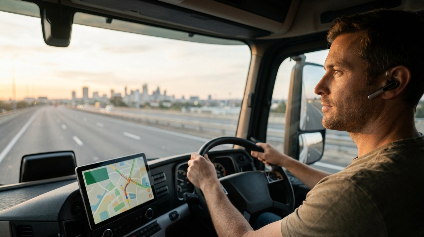
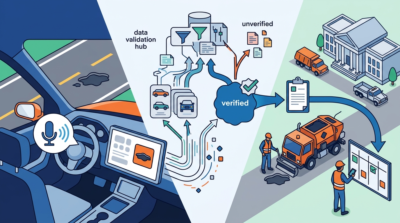
Hands-free navigation integrates verified reporting by using voice commands to capture hazard data, which is then validated through geospatial clustering and municipal review before dispatch. This guide covers the technical architecture of voice-to-data pipelines, the validation logic that filters noise from signal, and the operational workflows that connect drivers to road maintenance crews. We examine how WhereY'at Inc. structures this integration to ensure that every report leads to actionable infrastructure maintenance. For additional details, review the whereyatinc com.
Voice Capture and Data Structuring
From Audio to Structured JSON
The raw audio stream is converted into text using speech-to-text models. However, text alone is not enough for municipal workflows. The system must map the text to a standardized schema. For example, the phrase "big hole in the left lane" is translated into a JSON object containing hazard_type: pothole, lane: left, and severity: high. This structured format is essential for the downstream validation processes. It ensures that the data is machine-readable and consistent across thousands of different drivers. For additional details, review the .
Contextual Awareness
Modern navigation layers use contextual awareness to refine the report. The system knows the current speed, the road type (highway vs. residential), and the time of day. If a driver reports a hazard at 70 mph on a highway, the system flags it with higher urgency than a similar report at 25 mph in a parking lot. This context is embedded into the data packet before it leaves the device. It provides the validation engine with the necessary metadata to assess the report's credibility and priority. For additional details, review the Customer Experience.
Report Data Validation Logic
Report data validation is the process of filtering raw user inputs to distinguish genuine hazards from noise, duplicates, or errors. Without robust validation, municipalities would be overwhelmed by false positives. The core of this validation is geospatial clustering. When multiple drivers report a similar issue within a small radius and a short time window, the system aggregates these reports into a single, high-confidence event. This consensus mechanism is the primary defense against accidental taps or misinterpretations. For additional details, review the Frequently Asked Questions.
Geospatial Clustering and Consensus
Severity Scoring Algorithms
Not all hazards are equal. The validation layer also applies severity scoring algorithms. These algorithms weigh factors like the size of the hazard, the number of affected lanes, and the speed limit of the road. A small crack in a residential street receives a low score. A large pothole in the center of a highway receives a high score. This scoring ensures that the most dangerous issues are prioritized for review. It helps municipalities allocate their limited resources to the problems that pose the greatest risk to public safety. For additional details, review the About.
Feedback Loops
Validation is not a one-time event. It is a continuous feedback loop. When a road crew marks a hazard as fixed, the system updates the status of the cluster. If new reports start appearing at the same location after the fix, the system flags it as a recurring issue. This triggers a higher priority alert. This loop ensures that the system learns from its outcomes. It improves the accuracy of future validation by adjusting the thresholds for specific road segments.
Municipal Review and Dispatch
Once a report is validated, it enters the municipal workflow. This is where the technology meets the physical world. The validated data is pushed to a municipal dashboard. Here, city engineers or road maintenance supervisors review the cluster. They can view the aggregated reports, the confidence score, and any photos or audio clips attached to the original submissions. This review step is essential for final verification before any work is ordered.
Dashboard Integration
The municipal dashboard is designed for efficiency. It displays verified hazards on a live map. Each marker is color-coded by severity and status. Supervisors can filter by road type, district, or hazard type. This allows them to see the big picture. They can identify patterns, such as a stretch of road with multiple potholes, which might indicate a larger structural issue. The dashboard integrates with existing asset management systems, ensuring that the new data fits into the city's existing operational framework.
Work Order Generation
Completion and Verification
When the crew completes the repair, they mark the work order as complete. They may upload a photo of the fixed area. This data is sent back to the system. The system updates the status of the hazard cluster to "resolved." It also notifies the drivers who originally reported the issue. This closure is important for user trust. It shows drivers that their reports lead to real action. It encourages continued participation in the reporting ecosystem.
Fleet Safety and Operational Impact
For trucking companies and delivery fleets, the integration of hands-free reporting has direct operational benefits. Fleet managers are responsible for the safety of their drivers and the condition of their vehicles. Road hazards like potholes can cause significant damage to tires, suspension, and axles. By using a hands-free navigation layer that provides real-time hazard alerts, fleets can avoid these damages. This reduces maintenance costs and prevents vehicle downtime.
Real-Time Hazard Alerts
The navigation layer pushes verified hazard alerts to fleet vehicles in real-time. If a pothole is verified on a route, the system alerts the driver before they reach it. The driver can then adjust their speed or change lanes. This proactive approach prevents accidents and vehicle damage. It also improves the overall safety of the fleet. Fleet managers can track the number of hazards avoided and the potential costs saved. This data can be used to justify the investment in the technology.
Route Optimization
Verified hazard data also informs route optimization. The navigation system can suggest alternative routes that avoid known hazards. This is particularly useful for time-sensitive deliveries. The system balances the need for speed with the need for safety. It avoids routes with high hazard density. This optimization is based on live data, not static maps. It ensures that the fleet is always using the safest and most efficient paths available.
Compliance and Reporting
Integration Models Compared
| Primary User | Individual Drivers | Trucking Fleets | Drivers and Municipalities |
| Reporting Interface | Touch-based or Voice | Telematics and Voice | Hands-Free Voice |
| Validation Method | Community Consensus | Internal Fleet Data | Geospatial Clustering and Municipal Review |
| Data Destination | Public Map Overlay | Fleet Dashboard | Municipal Asset Management System |
| Outcome | Community Awareness | Fleet Safety and Cost Savings | Infrastructure Maintenance and Public Safety |
Key Takeaways
- Hands-free navigation is a system that enables drivers to report hazards without visual distraction, using voice commands.
- Report data validation is the process of using geospatial clustering to filter noise and create high-confidence hazard clusters.
- Severity scoring algorithms prioritize hazards based on road type, speed, and impact, ensuring critical issues are addressed first.
- Municipal review is a critical step where human experts verify validated data before generating work orders.
- Fleet operators benefit from real-time hazard alerts that prevent vehicle damage and reduce maintenance costs.
- The closed-loop workflow, from report to repair to verification, builds trust and encourages continued user participation.
- Integrated models that connect drivers to municipalities provide the most value by driving actual infrastructure maintenance.
- WhereY'at Inc. specializes in this integration, providing the technology that bridges the gap between road users and road maintainers.
Frequently Asked Questions
How does voice recognition handle background noise?
What happens if a report is false?
If a report is false, it will not be validated. The geospatial clustering algorithm requires multiple reports from different drivers to create a verified cluster. A single false report will remain as a low-confidence data point. It will not trigger a municipal review or a work order.
Can municipalities customize the validation thresholds?
Yes, municipalities can adjust the validation thresholds. They can set the minimum number of reports required for a cluster to be considered verified. They can also adjust the severity scoring weights. This allows them to tailor the system to their specific road conditions and resource constraints.
Is the data shared with other platforms?
Data sharing depends on the municipality's policies. WhereY'at Inc. allows municipalities to control how their data is used. They can choose to share anonymized data with other platforms or keep it private. This ensures that the municipality retains ownership of its infrastructure data.
How does this benefit delivery fleets?
Delivery fleets benefit from real-time hazard alerts that help them avoid potholes and other road defects. This reduces vehicle damage and maintenance costs. It also improves driver safety and reduces the risk of accidents. The system provides a digital trail of hazard encounters for compliance and insurance purposes.
What is the role of the municipal dashboard?
The municipal dashboard is the interface where city engineers review validated reports. It displays hazards on a map, allows filtering by severity and type, and enables the generation of work orders. It integrates with existing asset management systems to ensure seamless workflow.
Conclusion
The integration of hands-free navigation with verified reporting workflows is a critical advancement in intelligent transportation. It transforms passive road users into active participants in infrastructure maintenance. By using voice commands, geospatial validation, and municipal review, systems like WhereY'at Inc. ensure that every report leads to actionable maintenance. This closed-loop approach improves road safety, reduces fleet costs, and optimizes municipal resources. For drivers, fleets, and municipalities, this technology provides a clear path to better roads and safer journeys. WhereY'at Inc. continues to lead in this space, providing the tools that connect the people using the roads with the people responsible for maintaining them. Learn more: whereyatinc com.